
Norway’s capital city Oslo has a big cruise ship harbor where huge cruise ships bring in thousands of passengers daily all year round. Oslo is a great city to spend a full day as a cruise ship tourist, but the first thing you want to do when arriving in Oslo is to get from the cruise port to the actual Oslo city center.
We’re going to showing you how to easily get from the Oslo Cruise Terminals to Oslo City center in this article!
The Oslo Cruise Port is located just south of the main city center, which is within walking distance of Oslo’s city center. The walk is between 4 and 15 minutes, depending on which side of the harbor the cruise ship docks at. But just keep walking north (away from the fjord where the cruise ship came from) to get to the city center.
It’s a pretty easy and relaxing stroll that will show you some of the popular tourist spots in Oslo along the way, and I urge you to walk if you are in shape to do so. If not, just get in one of the many taxis that will be waiting at the port.
You can also get on the Oslo Jump-On Jump-Off Tour Bus directly from Oslo harbor, which makes it super easy to get to all the amazing attractions and sights in Oslo. Tickets to this bus can be bought here:
Walking directions to get from Oslo Port to the city center
We’re using Oslo S (the main public transportation hub in Oslo) as Oslo’s city center in this article. This is where Karl Johan’s Gate begins, which will take you trough the main shopping street, ending at the Royal Palace.
To get from Oslo Cruise Port to Oslo City Center, just follow the harbor promenade until you are next to the Opera House, then keep walking straight ahead for another 2 minutes. Make sure you see the Oslo Opera House and MUNCH Museum on your right to make sure you are walking in the correct direction.
Most cruise ships docks at Revierkaia, which is the dock closest to the city center. The walk from Revierkaia to Oslo S is just 4 to 7 minutes.
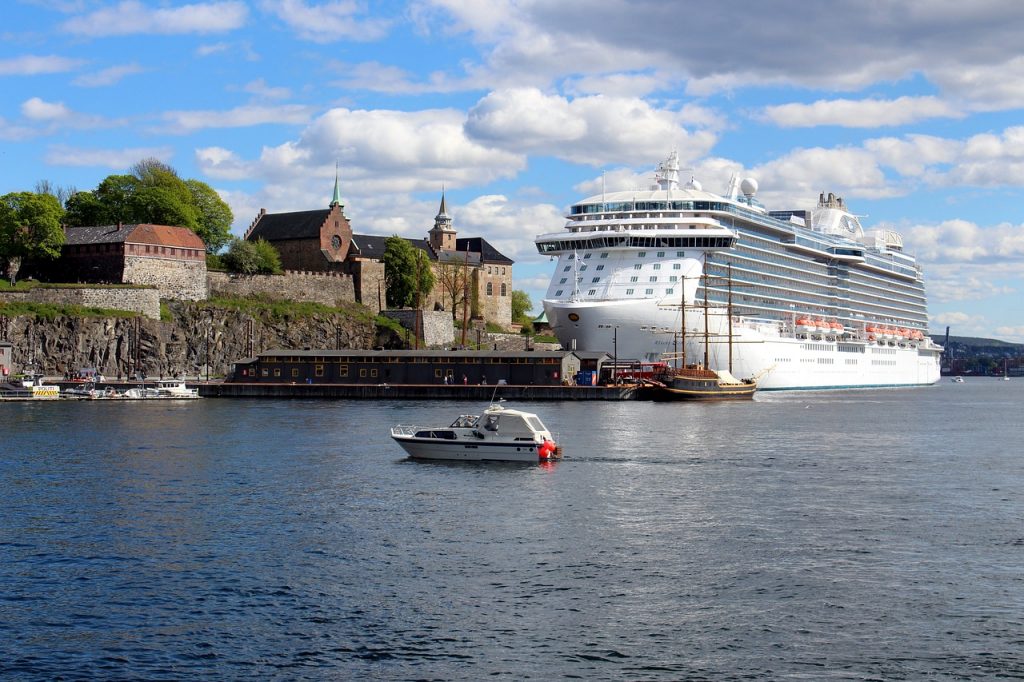
If your cruise ship dock on the other side (meaning that you will be looking directly at Akershus Fortress), the walk is a bit longer. However, the directions are mostly the same; walk south until you pass the tip of the half-island, then head north, passing by Revierkaia on your way.
While this might sound complex, the mantra is just to follow the harbor promenade. The total length of the stroll is just over 1,3 km, and takes roughly 20 minutes or so. It’s a nice and scenic stroll, so I urge you to walk if you are able to.
If you’re not up for the walk, then just get in one of the multiple taxis that will be waiting at the cruise harbor. They will be lining up and waiting for cruise tourists to get in, so feel free to use them as you wish. Keep in mind that taxis are insanely expensive in Norway before you get in though!

There are no good public transpiration options (it’s just a few minutes to walk after all), unless the cruise line offers a bus to certain points in the city.
Color Line docks much further away
If you’re coming to Oslo with the Color Line cruise ship from Kiel, then be prepared to be docked a bit further away from the city. The Color Line Terminal is about 3 kilometers away from Oslo S, which means a brisk 40 minute walk to get there.
However, it’s far from a bad thing if you want to explore Oslo as a tourist. The Color Line Terminal is actually pretty close to Bygdøy (where you will find museums like the Viking Ship Museum (closed for renovations until 2026), The Fram Museum, Oslo’s very own stave church, and many other attractions.

The terminal is also fairly close to Aker Brygge and the Royal Palace, so it’s a decent place to begin exploring Oslo after all.
The map below shows you how you can walk to Oslo S. It’s also possible to ride the bus to the city center if you don’t feel like walking.